Drone technology has changed things in many sectors, presenting new solutions for monitoring and keeping watch. Drone photography is being used as an important tool for real-time data collection, increasing efficiency and maintaining safety in industries like infrastructure development, construction work and farming among others. The industrial uses of drone photography are explored in this article, with a special focus on monitoring infrastructure developments, construction sites as well as agricultural land.
Monitoring Infrastructure
Infrastructure includes many different kinds of buildings and systems: roads, bridges, dams, pipelines and power plants are all part of it. It is very important to keep an eye on the condition and how well the infrastructure works because we must make sure people are safe while at the same time keeping everything running smoothly. Drone photography gives a low-cost way to do aerial inspections for infrastructure parts.
Inspectors can use drones with high-resolution cameras and sensors to take detailed images and videos of infrastructure assets from different angles. This aerial data helps engineers and maintenance teams identify defects, cracks, corrosion, or other signs that show deterioration that need attention. By finding problems at an early stage, it is possible to put in place preventative maintenance measures so as to lessen the chance of expensive fixes or infrastructure collapse.
Aerial Videography in Industrial Applications
Apart from drone photography, aerial videography also has a significant role in industrial use. It gives a lively visual understanding of infrastructure, construction areas and farm land. Drones with high-definition cameras can record stable and smooth videos to give a complete view of work happening in industries from above like a bird’s eye view.
For monitoring infrastructure, an aerial videographer assists inspectors and engineers in evaluating the situation of bridges, roads, and other structures at the present time. This method gives a detailed visual record of likely problems or dangers. When we make an aerial video recording of construction places, it helps project managers keep track of how things are going in terms of the progress made so far. They can also use it to look into workflow activities, thus enhancing communication with interested parties.
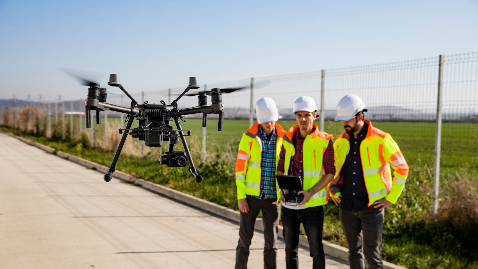
Construction Site Surveillance
The work at a construction site is complex, with many different parts that need to be coordinated. There are often tight schedules and high safety requirements. Managing progress, safety rules and resources effectively are very important in managing a construction site. Using drone photography can help construction companies with these tasks from start to end of their projects.
A drone can take pictures and videos from the air of building locations, giving useful visual data about how the project is going along as well as its productivity levels and site conditions to those managing it. When construction sites are observed often from an aerial view, project managers have the ability to recognize possible limitations, keep tabs on resource use and choose wisely for better work process while reducing dangers.
Moreover, drones that have the capacity for 3D mapping and modeling are capable of creating precise topographic maps, terrain models, and volumetric measurements on construction sites. This information helps project groups evaluate earthwork advancements, keep track of material stocks, and organize site logistics better. The skill to view and study site data instantly improves how projects are managed, and it makes communication between those involved easier.
Agricultural Land Management
In the farming industry, drone photography is changing usual methods of farming by giving farmers useful understanding about crop health, soil state and field management. Drones take clear images from the sky which help farmers to watch over big areas of land in a better way. These images assist them in making decisions based on data for improving harvest production and using resources effectively for their crops growth.
Drones which possess multispectral or hyperspectral cameras are capable of taking very precise images of crops. This helps farmers evaluate the health of plants, find signs showing that plants have diseases or lack certain nutrients, and locate areas in need of watering or controlling pests. Through this method, known as precision agriculture, it becomes possible to focus interventions on specific points, leading to a lessening of input expenditure and environmental influence while enhancing productivity.
Moreover, drones have the ability to perform jobs related to land surveying and mapping. This aids farmers in making field maps, evaluating soil productivity, and designing planting patterns more precisely. When drone data is combined with geographic information systems (GIS) and farm management software, it enables the creation of tailor-made agronomic prescriptions for better crop management matching particular field scenarios.
Conclusion
Monitoring Infrastructure, Construction Sites, and Agricultural Land: In industrial areas, such as checking infrastructure, construction locations, and farming land, drone photography has many advantages for enhancing efficiency, safety, and productivity. By using drones to carry out aerial inspections, surveillance activities, or data-gathering jobs – organizations can obtain useful understanding that assists in making decisions while optimizing the utilization of resources. As the technology of drones keeps growing and becoming more available over time, it is anticipated that their role in industrial applications will broaden further; this could spur innovation and change within different industries.